From Atlantic Cities:
We’ve made such a mess of the suburbs we constructed in the last fifty or so years that one wonders whether they can ever be made into something more sustainable. Strip malls, traffic jams, cookie-cutter subdivisions, diminished nature, almost no sense of outdoor community. We all know the drill: there are nice places to be in America’s recently built suburbs, but we have to know where they are and drive to them through a visual and environmental mess to get there.
One of the most challenging aspects of suburbs, and of the prescriptions for improving them, is the character of their roadways. Most of us take the poor design of our streets – the most visible part of most suburban communities, if you think about it – so much for granted that it never occurs to us that they actually could be made better for the community and for the environment.

Here’s how the county’s web site describes the initiative:
Streetscapes and public rights-of-way are valuable real estate, although people often forget they are not just about moving motor vehicles. They are also the front doors to homes, schools and businesses. As Montgomery County urbanizes and its spaces become more constrained, planners are re-considering how to create more value from our street-scapes.
The Planning Department conducted a year-long project on environmental site design focused on street edges. ESD integrates site design, natural hydrology, and other controls to capture and treat runoff.
In addition to collecting drainage and waste water, roadsides accommodate utilities, as well as provide space for pedestrians and off-road bicyclists, but trees and natural vegetation have often taken a back seat to other uses.
This project has resulted in plans for retrofitting road sections in suburban and urban areas to better handle storm water and improve the environment for pedestrians and cyclists in addition to motorists. Planners are working with County agencies and the County Council to establish policies to encourage ESD practices along county roads.”
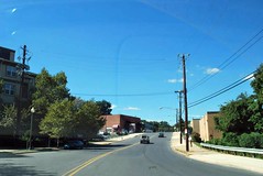
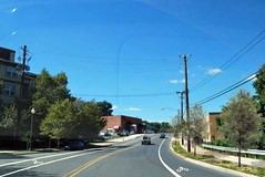
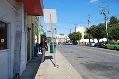
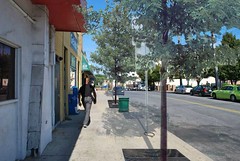
Montgomery hired SvR Design Company, a Seattle-based firm with extensive experience in green infrastructure and complete streets planning, to advise the initiative. Many of the images accompanying this post were contributed to the planning effort by SvR to illustrate the possibilities.
Note that the changes are not extensive, for the most part, but incremental: subtle narrowing of traffic lanes to slow auto speed; plantings in medians, along sidewalks and in parking lots to capture and filter rainwater; bike lanes and wider sidewalks to accommodate non-motorized users; striping to mark a people-first pedestrian lane where a sidewalk may not be feasible.
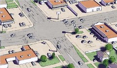
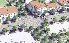
In addition to SvR’s images for Montgomery, I also wanted to show a before-and after illustration from Galina Tachieva’s fascinating Sprawl Repair Manual so that readers can imagine what an ambitious street makeover might look like when coupled with suburban redevelopment. Note especially the medians, street trees and, in the intersection, porous pavement that both filters additional stormwater and signals the presence of a distinct zone in the roadway where pedestrians are likely to be crossing. (Tachieva’s book is one of two great resources on fixing suburbs to emerge in the last three years; the other is Retrofitting Suburbia, by Ellen Dunham-Jones and June Williamson.)
There’s a lot to like about Montgomery’s initiative, including that it brings together three relatively new and successful – but often independently successful – lines of sustainability thinking and planning: redesigning suburbs; green infrastructure; and “complete streets” that accommodate all types of users. It reminds us that the greatest potential for sustainable communities lies with the integration of ideas and purposes. I hope this kind of initiative continues to catch on.
This post originally appeared on the NRDC’s Switchboard blog.



All that vacant land (a.k.a parkaing lots) = opportunity.